Zimlat
ZIMLAT (Zimmerwald Laser and Astrometry Telescope)
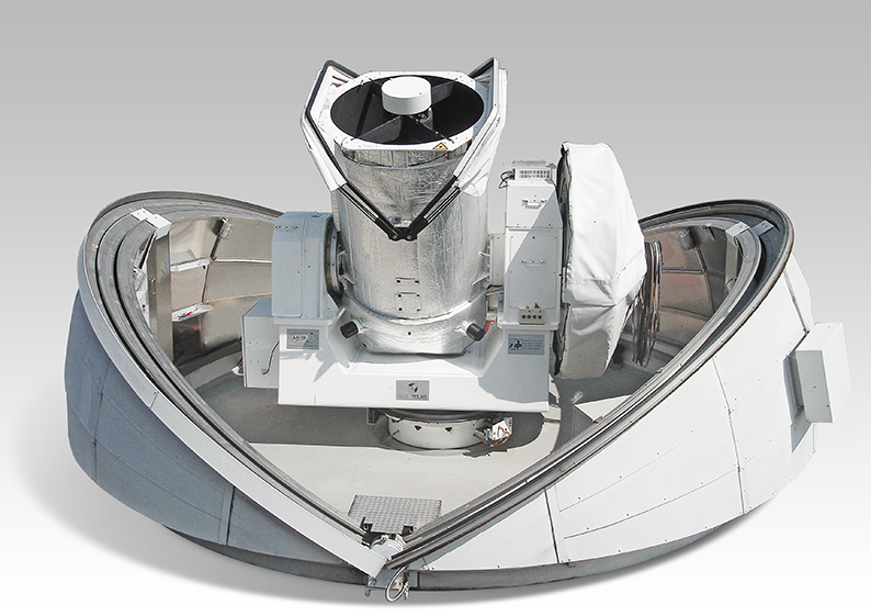
Technical Data
| 1m aperture |
| 4 focal stations: f=1.2, 4, 8m |
| 2k x 2k CCD |
| 3k x 3k CCD |
| Coudé path for Laser |
| Fast mount: 30°/s, 20°/s2 |
General Requirements
The 1-meter Laser and Astrometry Telescope (ZIMLAT), which has been in operation since 1997, is primarily intended to enable modern satellite laser ranging (SLR).
It can also be used as an astronomical telescope, to determine positions and brightness of near-Earth objects of all kinds using digital cameras (CCD).
This dual use of the system requires a high level of design complexity. Certain performance limitations,
such as in image quality or observation density, must be accepted.
The telescope, its auxiliary equipment, as well as the additional components for laser ranging, can be remotely controlled via the station computer.
High positioning and tracking accuracy is required:
Absolute: 1–2 arcseconds, important for hitting the satellites during distance measurement with a tightly focused laser beam
Relative: A few tenths of an arcsecond, enables "smooth" tracking of slow-moving objects
During the day and twilight, the system operates exclusively in SLR mode. At night, the available observation time
can be allocated to SLR and optical observations based on set priorities.
Switching between operational modes is quick and computer-controlled (within half a minute).
Astronomical Telescope
- High-precision tracking for
- stationary objects (geostationary satellites)
- slow objects (e.g., minor planets)
- fast objects (low-flying satellites)
- two tracking ranges
-
0–1 arcminute/second with exposure times of several minutes
-
0–1 degree/second with exposure times of a few tenths of a second
-
High image resolution: approximately 1" per CCD pixel
-
Field derotation according to various criteria
-
Fast switching between observation modes, i.e., multiple camera mounts with individual reduction optics
Satellite Laser Ranging (SLR)
-
Distance measurements to all satellites listed in the observation plan of the International Laser Ranging Service (ILRS) (at 300–25,000 km altitude)
-
Accuracy per single shot: a few millimeters to centimeters
-
Targeting accuracy and noise suppression also allow daytime observations
-
Fast switching between different satellites (10–20 seconds)
-
Remote control and monitoring (e.g., from the university)
-
Automated processes up to largely fully automatic operation
-
Dual-wavelength measurements, i.e., additional use of the primary (infrared) wavelength of the laser
-
10 to 20 degrees minimum elevation
-
Visual tracking control at night with a wide-field camera